This Old Bedford River campaign cruise turned out to be a surprisingly delightful experience and it didn’t take me long to understand why this neglected and apparently remote navigation has such a large and passionate group of supporters.
The adjacent semi-treed and scrub landscape to the west is totally different to that of the Middle Level (ML) only a few miles away in the same direction.
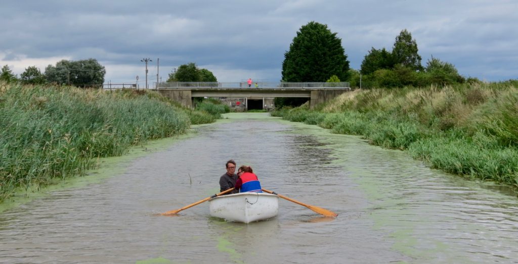
The village of Welney and its pub make an excellent half way stop and its road bridge gives good access to the Barrier Bank for long walks and more diverse views of the River Delph.
This really is a waterway worth saving and exploring.
Now that the IWA has given it a silver propeller its “go to” profile should be lifted, despite the discouraging dialogue heaped on it by the Environmental Agency (EA).
Background.
Vermuydens Old Bedford River (OBR) was dug in the 1630’s as a way of relieving flooding on the Lower Great Ouse. This new channel bypassed a long winding section of the river.
When, what today is known as the Middle Level began to be drained in the 1640s the Forty Foot Drain (FFD) was dug.
This drained by gravity the land which surrounded it down from Ramsey in the west, to the Old Bedford.
The FFD water then drained into the Old Bedford at what is now known as Welshes Dam Lock.
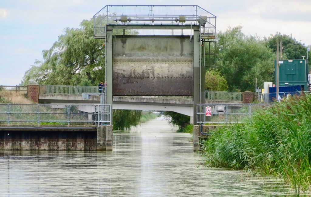
 Looking south up the Old Bedford River from the access
sluice bridge at Salters Lode
This additional water created a number of drainage problems on the Old Bedford which eventually resulted in the Sixteen Foot Drain being dug in the 1650s to intercept the waters of the FFD and bypass the Old Bedford altogether.
At some time (also believed to be in the 1650s) the original Welches Dam was built across the Old Bedford resulting in its northern section being effectively separated from the main Great Ouse system.
It then only acted as a local drain.
However the original right of navigation still exists on the Old Bedford up to the Mepal Pumping Station.
As with all UK navigations its significance as a navigation gradually diminished as railways and then road vehicles absorbed its commercial traffic.
However it remained a significant recreational navigation in the 1960s, it was the only way boats could pass from the Middle Level and R Nene to the Great Ouse.
In 1973 over 40 boats passed along the OBR on their way to the IWA National Rally at Ely without incident.
Unfortunately at about the same time Welches Dam Pumping Station was upgraded and over time this has created access problems at Salters Lode.
In 2006 the EA obstructed entry to Welches Dam Lock preventing craft passing through this lock and along the OBR.
Since this time the EA have neglected the navigation and have allowed the entry to the navigation at Salters Lode to silt up to a point where it had almost become unnavigable.
The reason for the IWA cruise was to bring to the publics notice the lack of maintenance on this statutory navigation and remind the EA of its legal responsibilities.
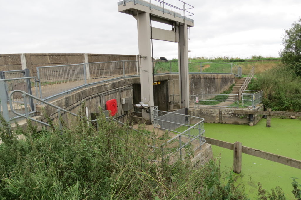
The Cruise up stream from Slaters Lode Sluice
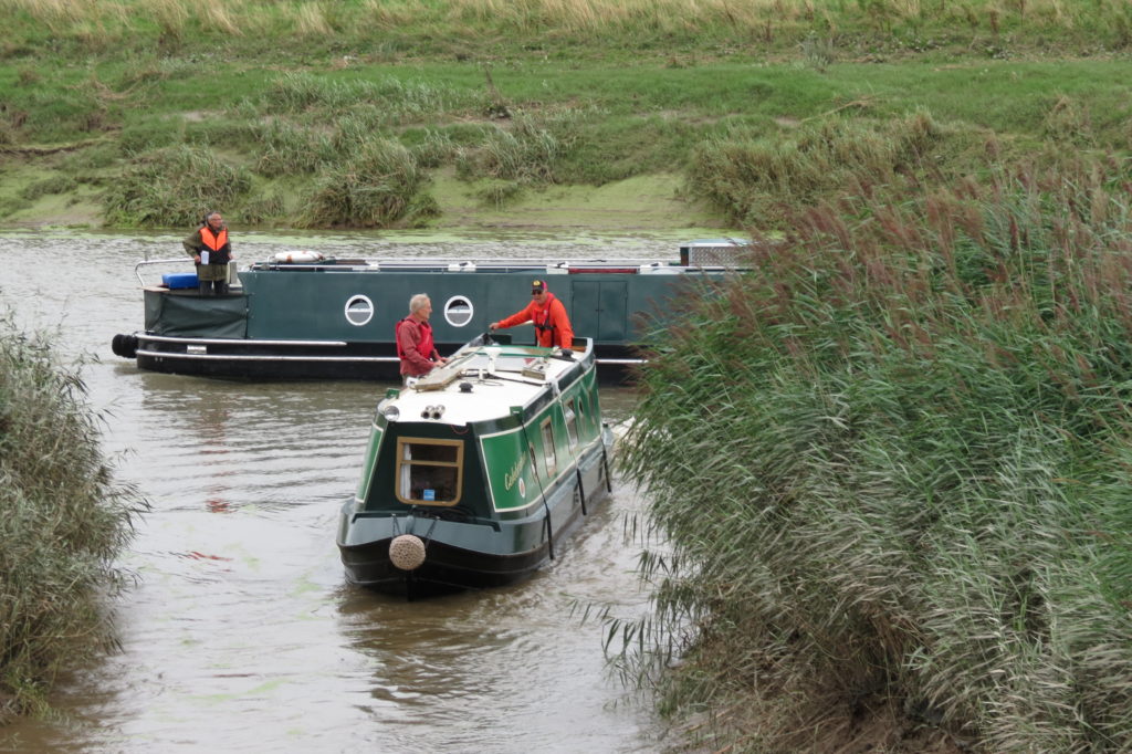
Boats on the tidal Great Ouse awaiting the tide to make a level with
the retained waters of the OBR before proceeding up the Old Bedford
The first boat entering what is now a narrow dog legged entry channel
The original river wall is behind the silting and reeds
to the rear left of the boat in the current channel.
Previously flows from the Old Bedford made this entry self clearing.
Unfortunately when the original tidal gate winching mechanisms were replaced with hydraulic arms the new arms and slacker (paddle) gear were placed in such a way as to prevent the doors opening to the full extent of the previous gates.
This has had the effect of reducing the size of the orifice between the doors which the flow of incoming water had to pass through in order to make a level with the water retained in the Old Bedford itself.
The effect of this flow restriction resulted in a water level differential building up between each side of the V gates.
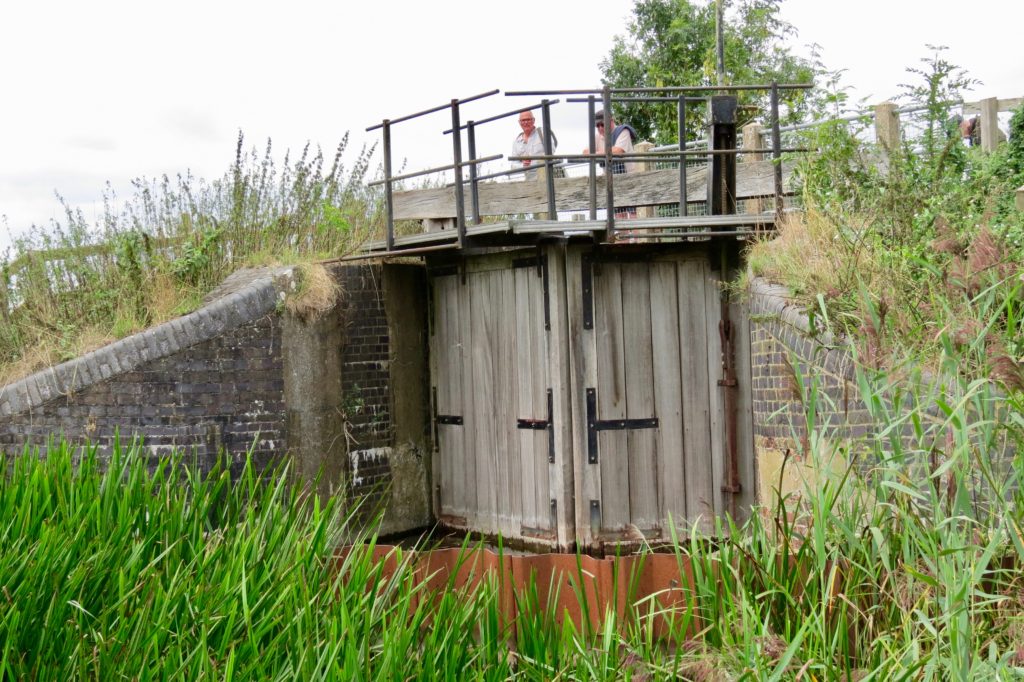
The open V gates and closed slacker gear of the OBR sluice
The concrete pads adjacent the ends of each gate held the
original gate opening and restraining chain gear.
The closed gate slackers can also be seen clearly.
Unlike with the original restraining chains, as the differential increased the modern hydraulics were unable to hold the gates in the open position long enough for the level to be made and any boats to pass through.
The problem was compounded by the fact that the large gate slackers could not be opened.
It is common practice to open gate slackers before lock gates are opened to reduce the water resistance acting on the gates as they are being opened.
If the slackers had been opened, the overall gate orifice would have been much enlarged.
The water level differential, would have been reduced and the limitations of the gate hydraulics would have been mitigated, increasing the boat access window.
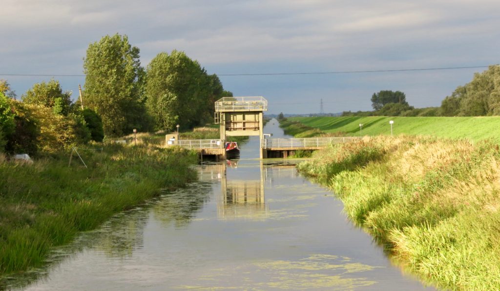
The guillotine gate which is located about 20 feet upstream of the V gates.
This gate built in 1995 replaced the second pair of gates and is used
to retain water in the OBR for irrigation of the adjacent farmland
for which the EA receives a fee.
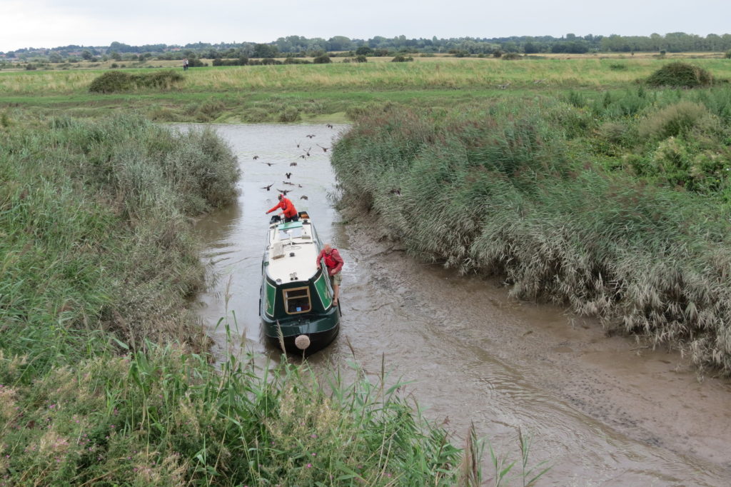
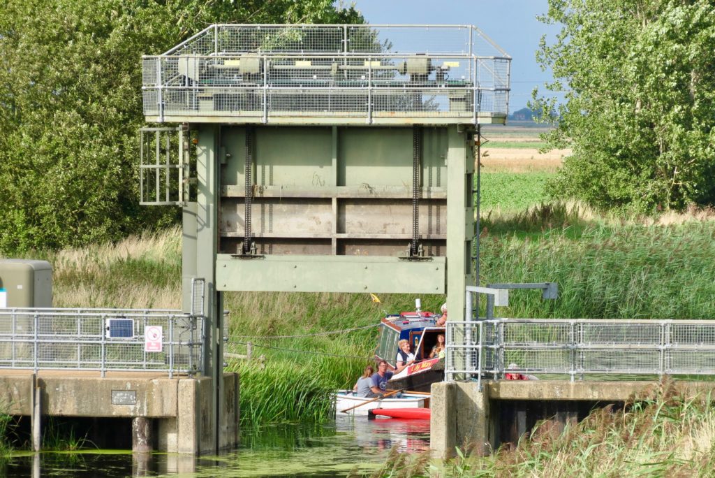
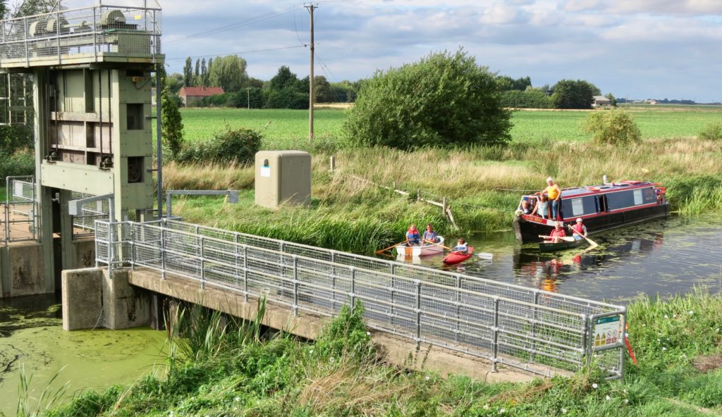
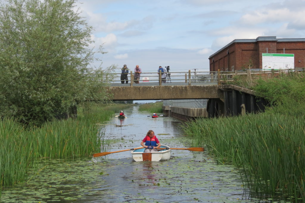
One of the small boats in the flotilla with the sluice and
War Memorial Road Bridge (MLC26) in the background.
This canoe is just coming up to an EA multi million
pound, Washes Barrier Bank raising operation.
At this point the water on the other side of the Barrier Bank is known as the
River Delph. It runs from the New Bedford River at Welmore Lake Sluice
up to what was the location of the original Welches Dam.
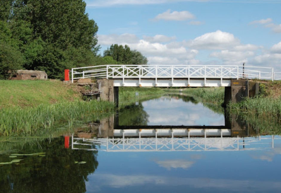
Welney Gate with the Welney Road Bridge in the background
This gate was installed in 1973-4 at the same time as the Welches Dam pumping station was upgraded to pump water from the Old Bedford into the River Delph on the other side of the Barrier Bank.
When the pumps are activated this gate is closed and only water south of the gate is evacuated from the Old Bedford.
It would seem that this pumping action has had the effect of scouring the Old Bedford’s river bed south of the gate.
The consequence being that when the gate is lifted, any water north of Welney Gate now gradually flows south and backwards away from its original and natural discharge point (tide and Stow Bridge Hump on the Great Ouse permitting) at Salters Lode.
It is considered by some that this is one reason why the silt dog leg in the Old Bedford entry channel has formed.
If this is so, it also means that the EA are spending money unnecessarily pumping water that could be discharged naturally at Salters Lode sluice.
Should an appropriate and full, one off dredging program take place on the Old Bedford and at Stow Bridge Hump, (on the Great Ouse) and the EA were to discharge from the Sluice on a more regular basis, it would seem likely that the mouth of the Old Bedford would remain as clear as it was in the past.
It has been suggested that by not allowing Salters Lode sluice to discharge as originally designed, the EA are deliberately avoiding the need to maintain Welches Dam Lock.
This is ironic as regular discharge would also save the EA pumping costs.
Delph Bridge and the unnavigable River Delph adjacent to
Welney Gate from the top of the Barrier Bank looking south.
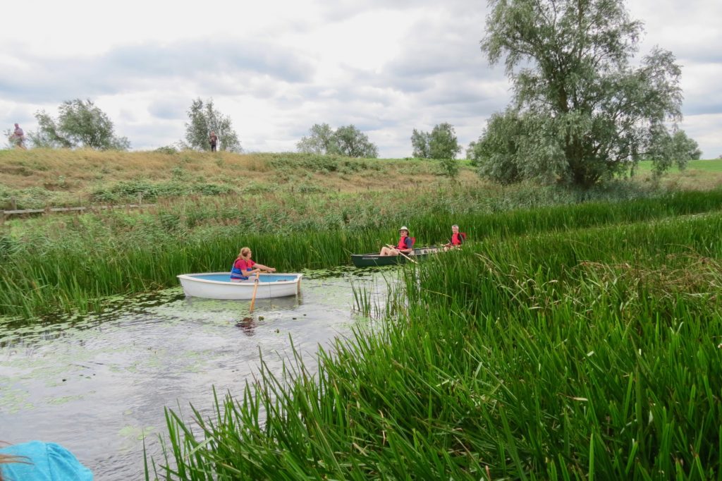
 Time for some R&R at Welney Gate landing
This was the end of the first days cruIsing and after a suitable brush up a large party of boaters and supporters gathered for an excellent dinner at the adjacent Lamb and Flag Inn.
 Boats moored at the site of what was the Welney OBR Boat Ramp
Unfortunately in addition to blocking access to the Old Bedford from Welches Dam Lock the EA have also removed the Welney trail boat ramp.
I am told that this now entails the EA incurring additional costs in lifting in its weed cutter or other work boats when Old Bedford Salters Lode Sluice is unusable as it was on this occasion.
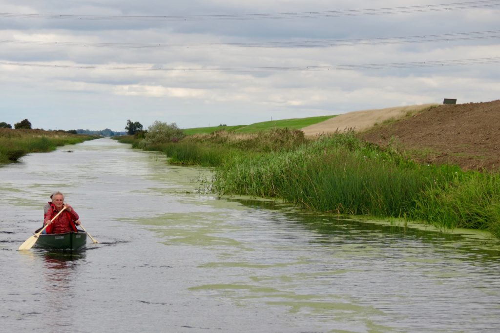
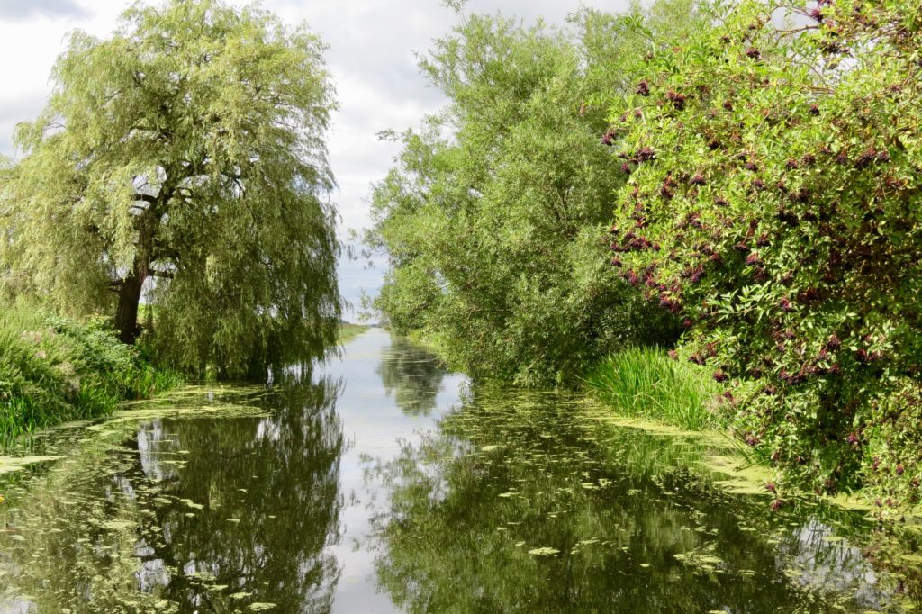 A delightful section of the Old Bedford
just above Welney Bridge
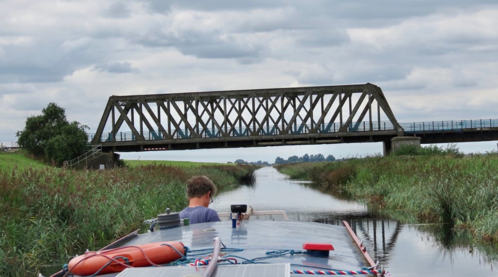
1847 built, Ely to Peterborough Rail Bridge, between Ely and March
 Welches Dam Pumping Station left and its access bridge
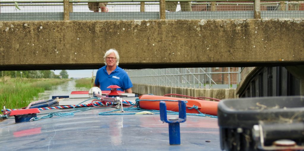 Chris Howes passing under the EA pumping station access bridge
 The approach to Welches Dam Lock
The old lock cottage, wharf and lock are on the right,
the channel also kinks to the right and continues upstream
to Mepal Pumping Station, as the Counter Wash Drain (CWD).
Building materials, then Coal and later Diesel were delivered by water to the Pumping Station.
The navigation up to Mepal is even more neglected than the section below the lock.
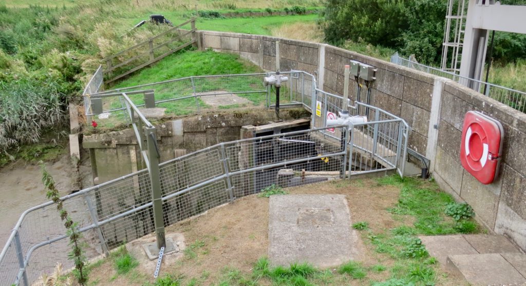
 Welshes Dam Lock, the illegal sheet piling can be seen
blocking the access to the lock
At the time of this visit the water level in the lock was considerably higher than that in the Old Bedford and the gates were still in good condition.
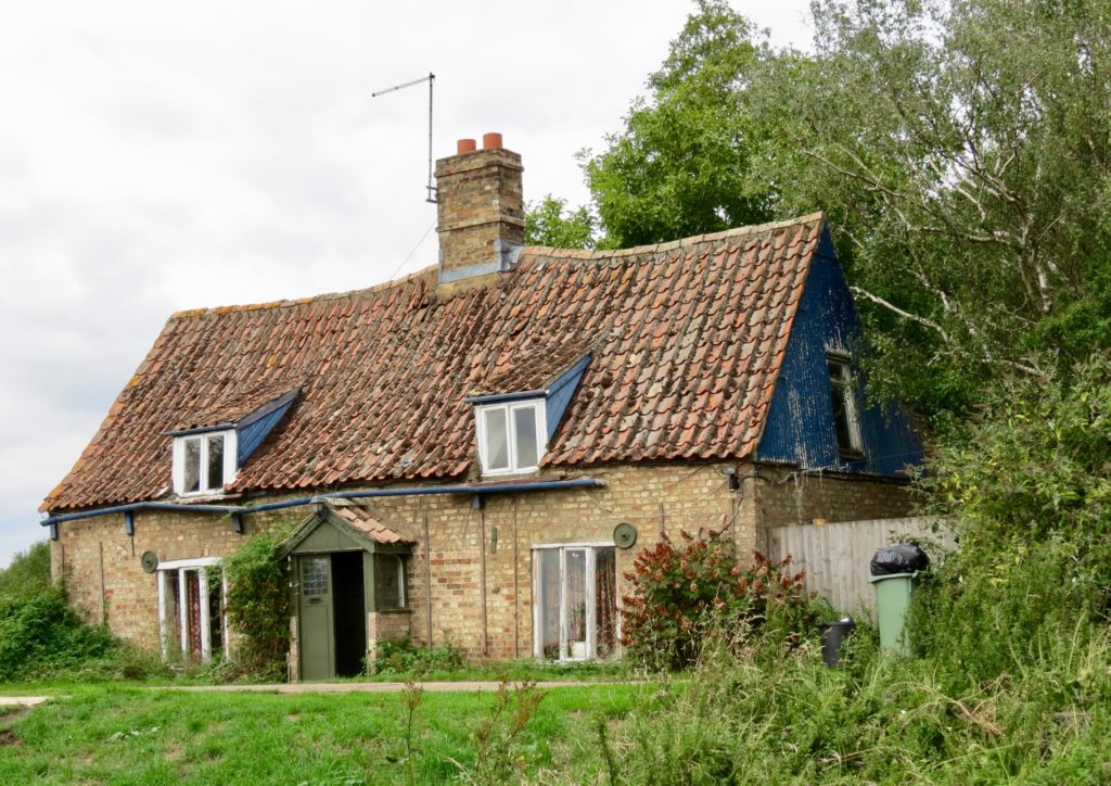
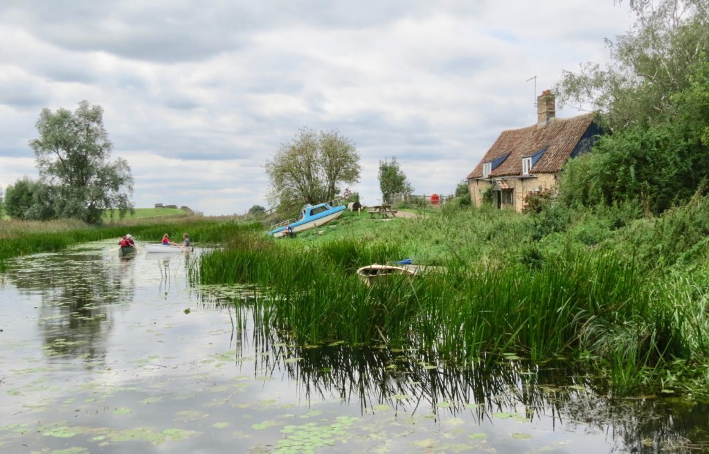
The extremely picturesque former lock cottage adjacent the lock
The canal to Mepal Pumping Station just south of the lock
This is the approximate location of the original Welches Dam which has resulted in the kink in the waterway and its change of name.
The channel south to Mepal now occupies what presumably would have been a Counter Wash Drain (CWD) and is now known as the OBR/CWD.
The water on the other side of the Barrier Bank (with its “Towing Path” 1890 OS map) seen in the background is the original OBR still on its original line.
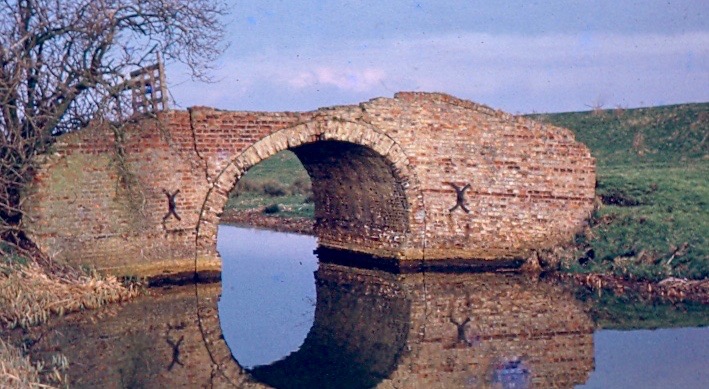
Fortrey’s Hall Br just below Mepal Pumping Station.
Demolished in the 1980s and replaced with a foot Br.
It would seem that Welches Dam created more problems than it solved so the River Delph was cut in the 1700s to feed water from the south Old Bedford back into the Great Ouse via the New Bedford River or into the Washes as the seasons required.
At Welches Dam, the New Bedford River is much further to the East.
And so to bed, said Zebedee.
Conclusions.
It would seem that the fortunes of this navigation have been heavily distorted by engineering works on adjacent waterways and a failure in legal guardianship by its navigation authorities, who ever they were at
the time.
Adjacent works have included the construction of Bedlam low bridge (17) on the SFD at 6′-4″ in the 1930s which reduced access from the Port of Wisbech via the Wisbech and Upwell Tramway and its wharfs at Outwell where coal was transhipped for waterway distribution.
Even more disastrous was the building of the low Ramsey Hollow Bailey Bridge (85) on the FFD, which not only cut access to the Old Bedford from the Middle Level towns of Benwick, Ramsey and March but prevented access to the Railway Interchange wharfs at Benwick and Holme.
It also hindered the development of recreational boating on the waters to the south east of the Middle Level.
Ramsey Hollow Bridge was lifted by the IWA in 2006 and now gives good access to the Old Bedford, however this still leaves ML headroom limitations of 6′-4″ at White Fen Br.(48) and Bridge 17 on the SFD.
In contrast the sterling work of Charlie Fox and the Well Creek Trust in clearing the blocked Well Creek between Upwell and Salters Lode in the 1970s, provided an alternative access to the Great Ouse for low headroom recreational craft (6′-5″) via Salters Lode Lk on the ML.
It is ironic that such good work by those with no legal obligation have made it possible for those with a legal obligation, to neglect that obligation.
Their excuse being lack of use.
This begs the question, how could this spurious attitude be altered for the economic benefit of the area and the public good in general?
White Fen Br, over the Old Nene (ML) now carries very large HGV vehicles way beyond its original design parameters and is nearing the end of its economic life. This farm shall soon require an alternative access.
White Fen Farm access bridge on the ML with its recently modified railings to allow large vehicles to cross.
As soon as this bridge is removed or lifted the Old Bedford will provide an improved headroom route from March, Whittlesey and the River Nene at Peterborough, to the Great Ouse thus helping to fulfill a part of the FWL proposal.
It would be extremely unfortunate if short term expediency by the EA prevented the reinstatement of this historic and potentially economically significant waterway for craft with over 6′-4″ headroom which cannot pass the MLC Salters Lode Lock via Well Creek.
This is particularly significant for GRP craft from the Great Ouse and River Nene which generally require over 6′-8″ (2.00m) headroom.